Google Maps Highlights A Rapid Spread Of Wildflower Fields In Texas
You can almost feel Texas waking up early this year as those wildflower fields keep popping up in spots that used to look plain and empty.
It’s the kind of sudden color burst that makes you stop scrolling on Google Maps just to zoom in and see if it’s really real.
I swear it feels like Texas is quietly showing off, spreading patches of blues, yellows, and pinks so fast that you catch yourself wondering how many new fields appeared while you were busy doing anything else.
And the best part is that every new cluster feels like a small surprise waiting for you to spot it before anyone else does.
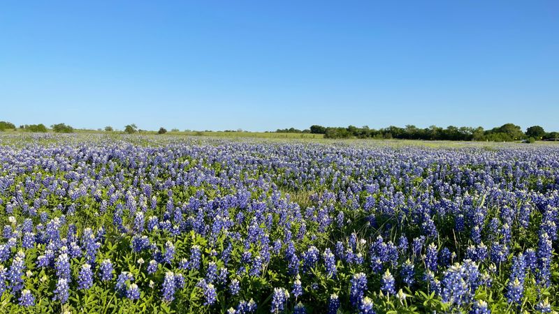
1. Ennis Bluebonnet Trails
Ennis proudly calls itself the Official Bluebonnet City of Texas, and one look at Google Maps during spring proves why this title fits perfectly.
Located about forty miles south of Dallas near 100 W Brown St, Ennis, TX 75119, this charming town transforms into a purple paradise every April.
The Ennis Garden Club maps out over forty miles of trails that wind through countryside bursting with bluebonnets and other colorful wildflowers each season.
Families pack picnic baskets and cameras to capture memories among flowers that seem to stretch endlessly across the rolling landscape of North Texas.
Local festivals celebrate the blooms with food vendors, live music, and arts and crafts that highlight the region’s agricultural heritage and community spirit.
Google’s satellite view captures the transformation from brown winter fields to vibrant blue carpets that attract visitors from across the entire United States.
2. Willow City Loop
Willow City Loop near Fredericksburg offers one of the most photographed wildflower drives in all of Texas Hill Country around FM 1323, Fredericksburg, TX 78624.
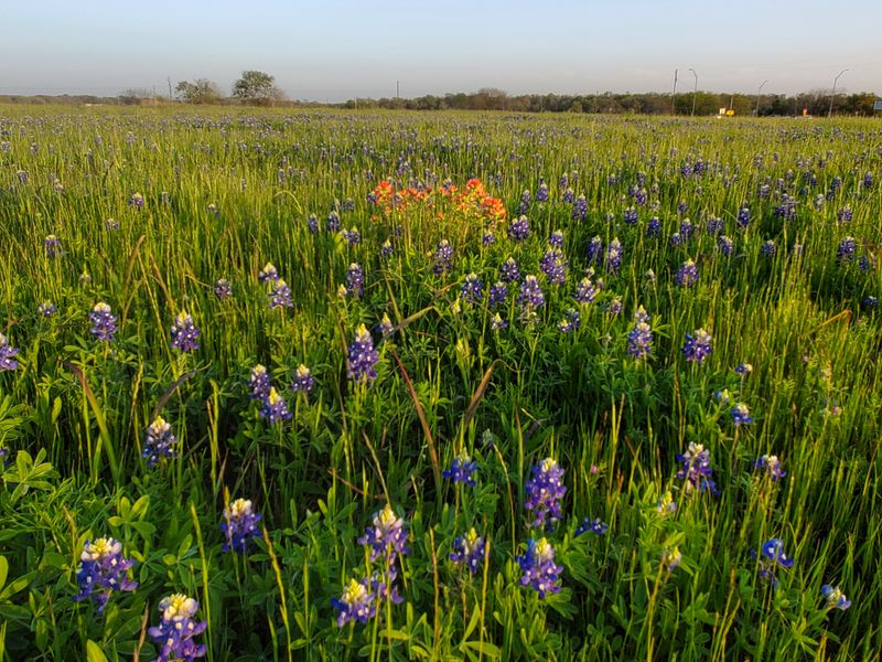
This thirteen-mile scenic route becomes a bucket-list destination when bluebonnets mix with red Indian paintbrush, creating a patriotic display across limestone hills and valleys.
Google Maps reveals how the flowers follow the contours of the land, creating natural patterns that look almost painted from above during peak bloom.
Ranchers and landowners along the loop welcome respectful visitors who want to admire the flowers while staying on public roadways and designated viewing areas.
Early morning light creates the best conditions for photography as dew glistens on petals and soft sunshine illuminates the colorful tapestry below towering oak trees.
The loop connects several small communities where local shops sell wildflower honey, jams, and artwork inspired by the natural beauty surrounding them year-round.
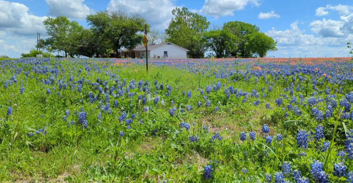
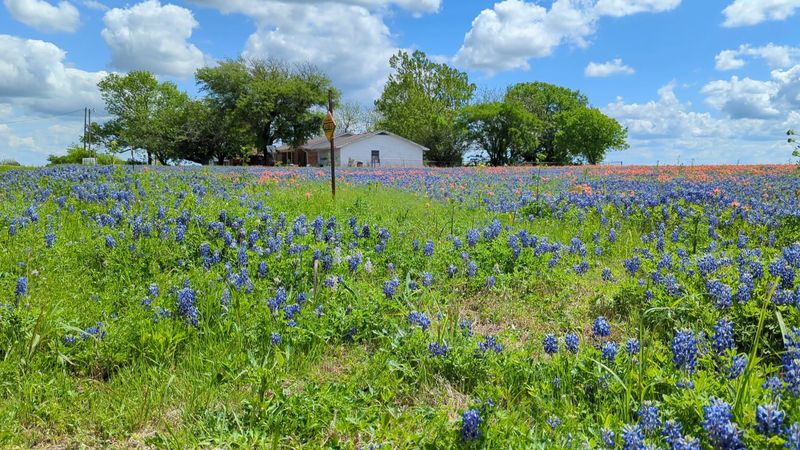
3. Brenham and Washington County
Washington County surrounding Brenham near 115 W Main St, Brenham, TX 77833 has earned a reputation for reliable wildflower displays that Google Maps captures beautifully.
Farm roads crisscross the countryside, providing countless opportunities to spot bluebonnets growing alongside fences, in pastures, and around historic structures that dot the landscape.
This region sits between Houston and Austin, making it a convenient stop for travelers seeking Instagram-worthy flower photos without straying too far off highways.
Local residents take pride in their wildflower heritage, often planting extra seeds and protecting natural areas where native species return reliably each spring season.
Your Texas Garden Changes Every Week. Your Plan Should Too.
Gardening in Texas changes quickly throughout the season. Every Friday you’ll receive a simple weekly plan showing exactly what to plant, prune, fertilize, harvest, and protect so you never miss the right timing.
Brenham itself is famous for Blue Bell Creamery, so visitors can combine flower viewing with tours and ice cream tastings for a perfect Texas day.
The aerial views on Google Maps show how agricultural practices and natural landscapes blend together, creating ideal conditions for wildflowers to thrive abundantly.
4. Muleshoe Bend Recreation Area
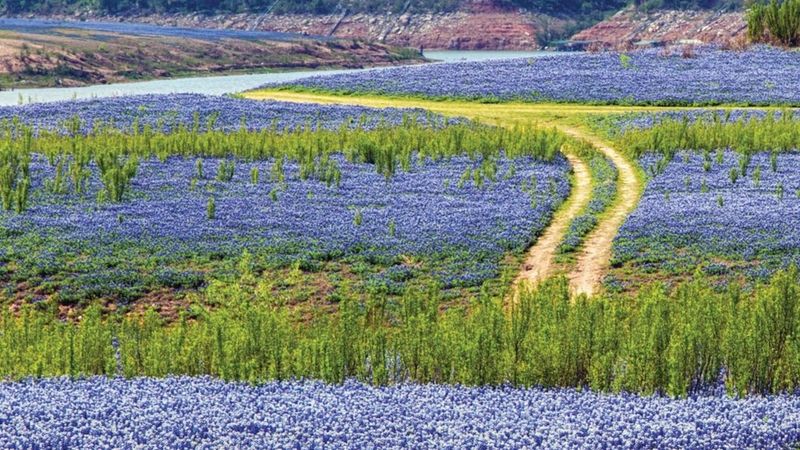
Muleshoe Bend Recreation Area along Lake Travis near 2820 CR 414, Spicewood, TX 78669 combines water views with wildflower meadows in spectacular fashion.
Google Maps satellite imagery shows how the flowers spread across the peninsula that juts into the lake, creating a colorful contrast against blue water below.
Managed by the Lower Colorado River Authority, this area offers camping, hiking, and picnicking among landscapes that burst into color every spring without fail.
Bluebonnets dominate the display, but sharp-eyed visitors also spot wine cups, Indian blankets, and other native species that add variety to the palette.
The location provides a quieter alternative to more crowded wildflower destinations while still delivering the stunning views that make Texas springs so memorable for residents.
Trails wind through the property, allowing hikers to experience the flowers up close while enjoying breezes off the lake that keep temperatures comfortable.
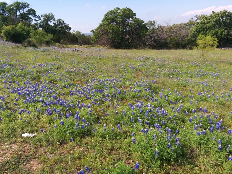
5. Llano County
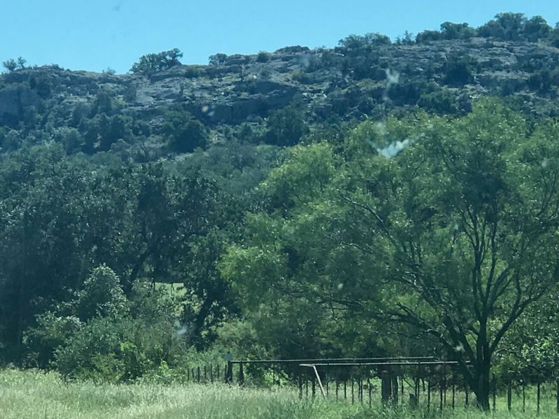
Llano County in the heart of Hill Country near 801 Ford St, Llano, TX 78643 consistently ranks among the top wildflower destinations visible on Google Maps.
The granite formations and sandy soils create perfect growing conditions for bluebonnets that return in impressive numbers year after year across the region.
Highway 16 south of Llano and Ranch Road 152 are particularly famous for their roadside displays that stretch for miles through open countryside.
Ranching remains the primary industry here, and many property owners appreciate the wildflowers as natural beauty that requires no maintenance or watering at all.
Small towns like Llano and Kingsland host wildflower festivals that celebrate the blooms with music, food, and guided tours to the best viewing spots nearby.
From above, Google Maps reveals how the flowers follow creek beds and natural drainage patterns, demonstrating how wildflowers thrive where water collects temporarily.
6. Chappell Hill

Chappell Hill near Main St, Chappell Hill, TX 77426 maintains its historic charm while showcasing some of the most reliable wildflower displays in Central Texas.
This small community between Houston and Austin hosts an annual Bluebonnet Festival that draws thousands of visitors eager to see the flowers at their peak.
Google Maps clearly shows how the flowers spread across the gently rolling terrain that surrounds the town, creating a patchwork of color and green pastures.
Many of the historic homes and buildings in Chappell Hill date back over a century, providing beautiful backdrops for wildflower photography enthusiasts visiting each spring.
Farm roads like FM 1155 and FM 2447 wind through the countryside, offering multiple routes for leisurely drives through landscapes painted with bluebonnets and paintbrush.
Antique shops and local restaurants in town provide perfect stops for refreshments after spending hours admiring the natural beauty that surrounds this charming community.
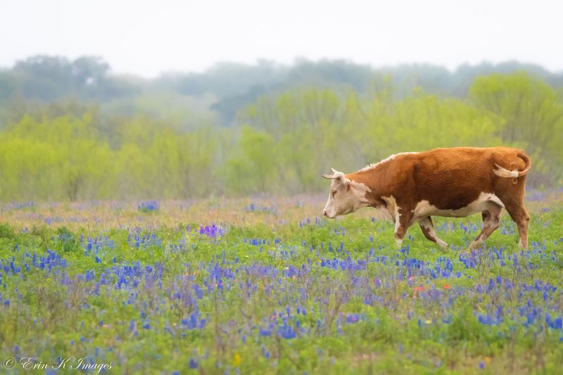
7. Burnet County

Burnet County near 220 S Pierce St, Burnet, TX 78611 proudly claims the title of Bluebonnet Capital of Texas, and satellite images support this claim.
The Highland Lakes region within Burnet County offers diverse landscapes where wildflowers thrive in meadows, along roadsides, and around the granite domes that define the area.
Highway 281 between Marble Falls and Burnet becomes a must-see route during peak season when flowers blanket both sides of the road continuously.
Google Maps reveals how the flowers cluster near water sources and in valleys, following natural patterns that have repeated for countless generations before modern observation.
Local businesses embrace the wildflower tourism, offering guided tours, special events, and wildflower-themed merchandise that celebrates the regional natural heritage proudly displayed each year.
Visitors often combine wildflower viewing with visits to nearby wineries, state parks, and lakeside attractions that make Burnet County a well-rounded destination for families.
8. Poteet Strawberry Fields
Poteet near 105 N River Ave, Poteet, TX 78065 is famous for strawberries, but Google Maps also reveals impressive wildflower spreads surrounding the agricultural area.
Located south of San Antonio, this region offers a different landscape than Hill Country, with flatter terrain that allows flowers to spread in broad sheets.
The combination of cultivated strawberry fields and wild bluebonnets creates an interesting contrast between human agriculture and natural beauty thriving side by side successfully.
Many farmers in the area plant wildflower seeds along field edges and unused spaces, enhancing the natural displays that attract photographers and nature lovers alike.
The annual Poteet Strawberry Festival coincides with peak wildflower season, allowing visitors to enjoy both sweet berries and stunning flower displays during one memorable trip.
Farm roads throughout the area provide quiet routes for exploring the countryside, where wildflowers mix with mesquite trees and prickly pear cacti typical of South Texas.
9. Independence and Brenham Corridor
The corridor between Independence and Brenham near FM 50, Independence, TX 77833 offers a historic route through some of Washington County’s best wildflower country.
Independence holds special significance as the birthplace of Texas independence, and the wildflowers add natural beauty to this historically important landscape each spring season.
Google Maps satellite view shows how the flowers follow the gentle topography, creating ribbons of color that connect small communities and historic sites throughout the area.
Old churches, cemeteries, and homesteads provide poignant reminders of Texas history while bluebonnets bloom around them just as they did for earlier generations.
FM 390 and FM 50 are particularly scenic during peak bloom, offering numerous pullouts where visitors can safely stop to photograph the flowers covering fields.
Local historians note that early Texas settlers would have seen similar wildflower displays, creating a living connection between past and present that resonates deeply today.