Google Maps Shows Tree Canopy Thinning Rapidly In Urban Texas Neighborhoods — Here’s What Locals Are Noticing
Texas residents keep pointing out how different their neighborhoods look from above, and the thinning tree canopy is becoming a major topic of conversation this year.
Each new satellite view reveals gaps that weren’t there before, showing patches of land that feel brighter but far less shaded than people remember.
The steady changes are encouraging more locals to pay closer attention to development, heat, and the small details shaping the future of their urban landscapes.
1. Bastrop State Park and Surrounding Areas
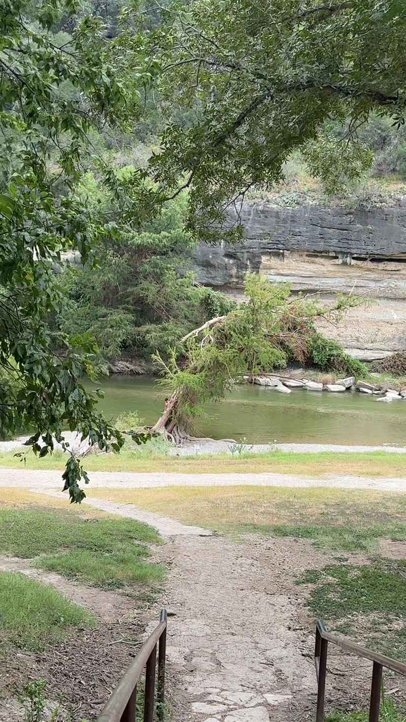
Bastrop State Park, located near 100 Park Road 1A in Bastrop, Texas, has faced significant challenges over recent years.
Wildfires swept through this region back in 2011, burning thousands of acres of beautiful Lost Pines forest that made this area so special.
When you look at Google Maps satellite view, the difference between healthy forest and recovering areas becomes really obvious.
Many sections still show sparse tree coverage compared to what existed before the fires hit the region hard.
Recovery efforts are underway across Bastrop County, but trees take decades to grow back to their former glory and provide the same level of shade.
Local organizations and volunteers plant new seedlings regularly, hoping to restore what was lost during those devastating fires.
The thinning canopy affects local wildlife that depended on dense forest for shelter and food sources throughout the year.
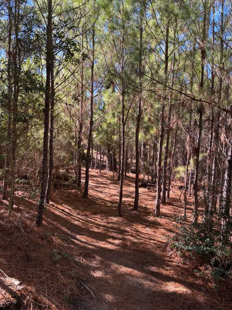
2. East Texas Piney Woods Region
Stretching across multiple counties in East Texas, the Piney Woods have always been a treasure for nature lovers and outdoor enthusiasts alike.
Commercial logging operations, combined with drought conditions and beetle infestations, have taken a serious toll on tree density throughout this region.
Google Maps reveals large patches where pine forests appear noticeably thinner than they did just a few years ago across the landscape.
Tyler and Nacogdoches counties show particularly visible changes when comparing older satellite images to more recent ones available online.
The southern pine beetle, a tiny insect smaller than a grain of rice, has devastated thousands of acres by burrowing into tree bark.
Landowners near places like Davy Crockett National Forest work constantly to monitor forest health and remove infected trees before beetles spread further.
Thinning canopy means less habitat for birds, squirrels, and other creatures that call the Piney Woods of Texas their home.
3. Austin’s Urban Forest Corridor
Austin, the capital city of Texas, prides itself on keeping the city weird and wonderfully green with trees lining streets and parks.
Development pressure and extended drought periods have caused noticeable thinning in urban tree canopy across neighborhoods throughout the metropolitan area.
Satellite imagery on Google Maps shows that areas around Zilker Park and the Barton Creek Greenbelt have experienced significant canopy reduction.
Construction of new homes, roads, and commercial buildings often requires removing mature trees that took fifty years or more to grow.
City officials near addresses like 2100 Barton Springs Road try to balance growth with conservation, but the challenge remains incredibly difficult.
Heat island effects become worse when tree cover decreases, making Austin summers even hotter than they already are for residents.
Community groups organize tree planting events regularly, encouraging citizens to help restore the urban forest one sapling at a time throughout Texas.
4. Houston’s Memorial Park Area
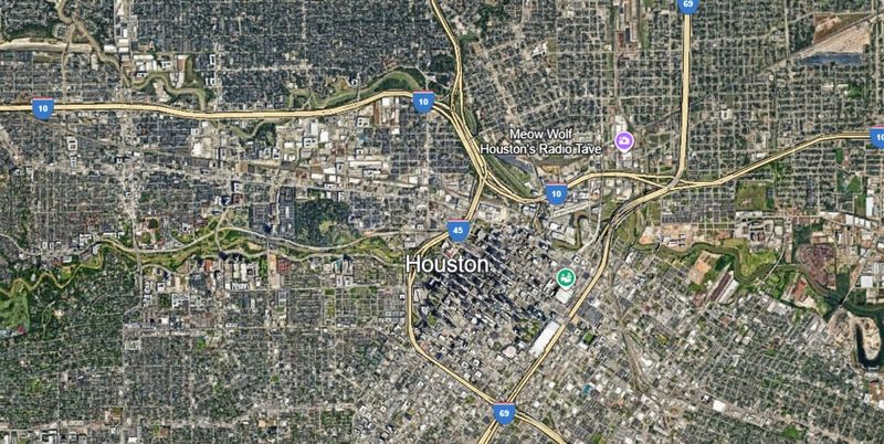
Memorial Park in Houston, located near 6501 Memorial Drive, represents one of the largest urban parks in the entire United States today.
Hurricane damage, particularly from storms like Harvey and Ike, stripped away portions of the tree canopy that once covered trails and picnic areas.
Google Maps satellite view clearly shows sections where dense forest has given way to more open spaces with fewer mature trees standing.
Park officials have launched ambitious restoration projects to replant native species and rebuild the forest ecosystem over the coming decades ahead.
Flooding combined with high winds toppled countless trees, leaving gaps in the canopy that will take years to fill back in completely.
Runners and hikers who frequent the park notice the difference immediately, with less shade available along popular trails throughout Harris County.
The park’s Master Plan aims to restore forest health while improving recreational facilities for the millions who visit this Houston treasure annually.
5. San Antonio River Walk Surroundings
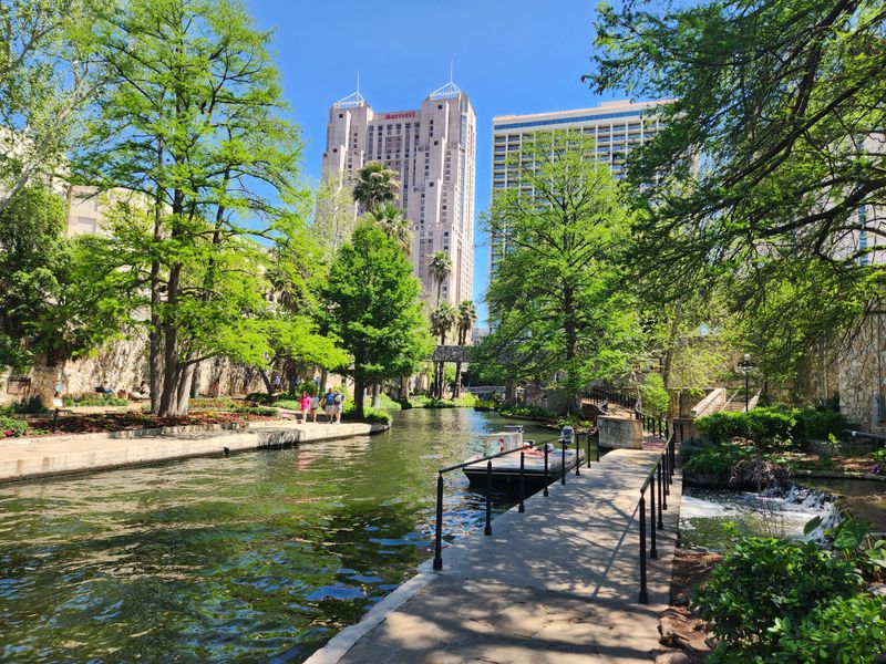
The famous River Walk brings tourists from around the world to San Antonio, but the surrounding areas face environmental challenges affecting tree health.
Urban development and water management issues have contributed to declining tree canopy in neighborhoods near downtown and along the river corridor itself.
When examining Google Maps, you can spot areas around 849 East Commerce Street where tree coverage appears noticeably thinner than in past years.
Cypress trees and other riparian species struggle when water levels fluctuate dramatically due to drought or upstream water usage throughout Bexar County.
City planners work to protect existing trees while accommodating growth, but finding the right balance proves challenging in this rapidly expanding Texas city.
Shade from trees keeps the River Walk cooler and more pleasant for visitors strolling along the pathways during hot summer months here.
Conservation groups partner with local government to plant new trees and protect mature specimens that define the character of San Antonio today.
6. Dallas-Fort Worth Metroplex Suburbs
Rapid suburban expansion across the Dallas-Fort Worth area has transformed farmland and natural areas into neighborhoods, shopping centers, and highways at record speed.
Google Maps satellite imagery reveals dramatic canopy loss in cities like Frisco, McKinney, and Arlington where development continues to boom across North Texas.
Areas near addresses such as 5601 Granite Parkway in Plano show how quickly tree-covered land can transform into commercial and residential zones.
Developers often clear entire tracts of land before building, removing established trees that provided habitat and helped filter air and water naturally.
Some municipalities require developers to preserve a percentage of existing trees, but enforcement varies widely across different cities and counties here.
The loss of tree canopy contributes to higher temperatures and increased stormwater runoff, creating environmental challenges for communities throughout the Metroplex region.
Residents increasingly advocate for stronger tree protection ordinances to preserve the green spaces that make Texas neighborhoods more livable and attractive overall.
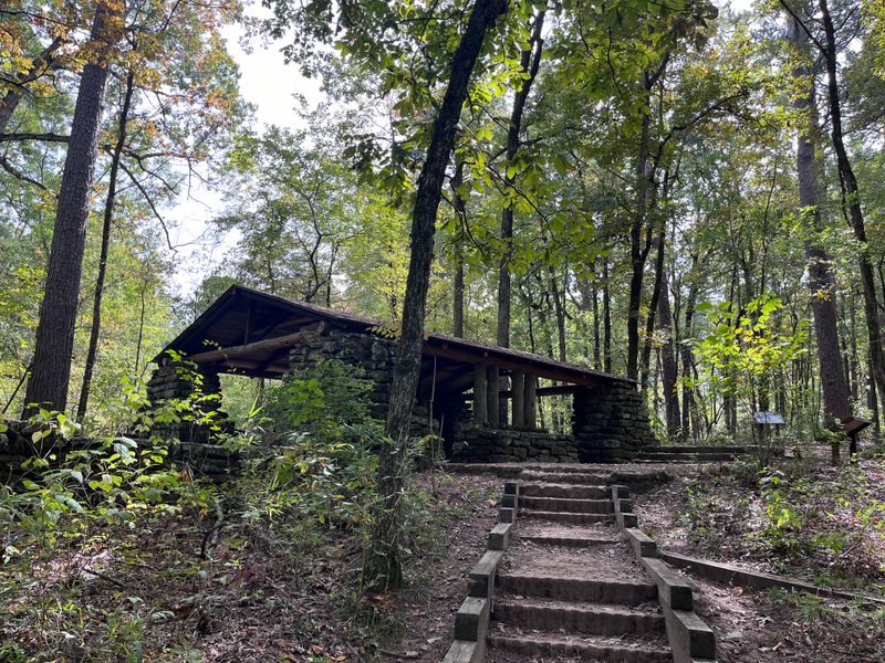
7. Big Thicket National Preserve
Big Thicket National Preserve, located near 6102 FM 420 in Kountze, Texas, protects a unique biological crossroads where multiple ecosystems converge.
Despite federal protection, portions of the preserve show canopy thinning visible on Google Maps due to natural stressors and changing climate patterns.
Prolonged drought conditions stress trees, making them vulnerable to disease and insect infestations that spread quickly through weakened forest stands across the region.
Park rangers monitor forest health closely, but resources for active management remain limited across the vast acreage of this protected area.
The preserve’s diverse tree species, including hardwoods and pines, respond differently to environmental stressors, creating a patchwork of healthy and struggling areas.
Visitors hiking the trails notice thinning canopy in certain sections, with more sunlight reaching the forest floor than in previous years here.
Scientists study these changes to understand how Texas ecosystems adapt to shifting conditions and what interventions might help preserve forest integrity long-term.
8. Guadalupe River State Park Region
Guadalupe River State Park near 3350 Park Road 31 in Spring Branch offers beautiful scenery, but the surrounding area faces tree canopy challenges.
Extended drought periods combined with increased recreational use have stressed riparian forests along the river corridor throughout Comal and Kendall Counties in Texas.
Google Maps shows sections where bald cypress and sycamore trees appear less dense than they did before recent dry years took their toll.
River levels drop during drought, leaving trees without adequate water to maintain healthy growth and resist pests that attack weakened specimens throughout the region.
Park officials work to educate visitors about staying on designated trails to minimize soil compaction and root damage around sensitive tree zones.
The thinning canopy affects the river ecosystem, reducing shade that keeps water temperatures cooler for fish and other aquatic life living here.
Community efforts focus on water conservation and habitat restoration to help the forest recover and thrive for future generations who visit this Texas gem.
9. Caddo Lake State Park Area
Caddo Lake, straddling the Texas-Louisiana border near 245 Park Road 2 in Karnack, is famous for its mysterious cypress swamps and wildlife.
Changing water levels and invasive species threaten the iconic bald cypress trees that give this area its unique character and ecological importance.
Satellite images on Google Maps reveal areas where cypress canopy appears thinner, with dead trees standing like ghostly sentinels in the shallow water.
Giant salvinia, an invasive aquatic plant, covers water surfaces and blocks sunlight from reaching native plants and young cypress seedlings trying to establish themselves.
Water management decisions upstream affect lake levels, sometimes leaving cypress roots exposed or flooding areas for extended periods beyond what trees tolerate.
Local conservation groups work tirelessly to remove invasive plants and advocate for water policies that support the health of this unique Texas ecosystem.
The thinning canopy changes the character of Caddo Lake, affecting tourism and the many species that depend on healthy cypress forests for survival.
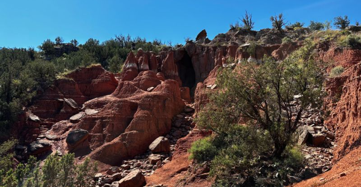
10. Palo Duro Canyon State Park Surroundings
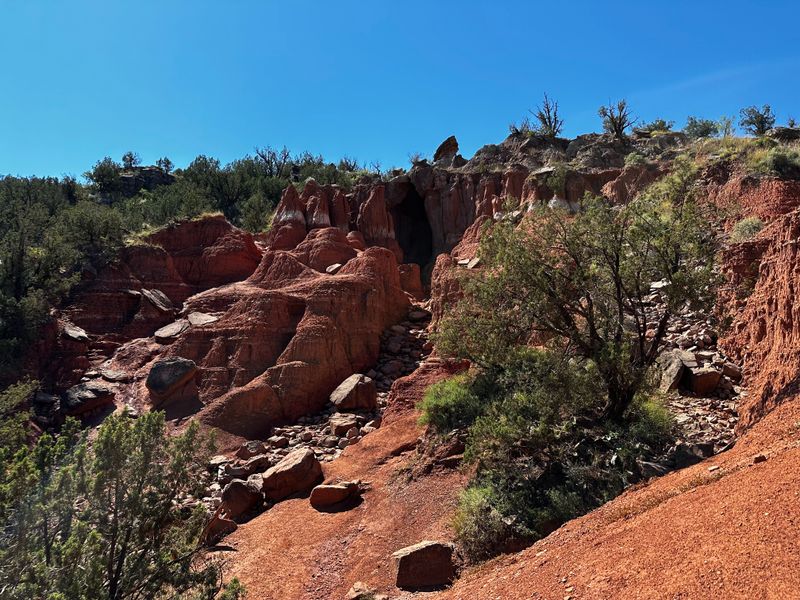
Palo Duro Canyon, located near 11450 Park Road 5 in Canyon, Texas, is the second-largest canyon system in the United States today.
While not heavily forested, the juniper and cottonwood trees that do grow here face increasing stress from drought and temperature extremes.
Google Maps shows noticeable thinning of tree clusters along the canyon floor and near water sources where vegetation typically concentrates in this arid region.
Cottonwood trees depend on consistent water from streams and springs, which become less reliable during extended dry periods across the Texas Panhandle.
Junipers, though drought-tolerant, struggle when conditions become too extreme, leading to canopy dieback visible from satellite imagery over time in this area.
Park managers monitor tree health and work to protect water sources that sustain the limited but important tree cover in the canyon ecosystem.
Visitors appreciate the shade provided by these trees during hot summer days, making their preservation important for both ecology and recreation in Texas.