North Carolina’s Most Scenic Lake Road Trip You Need To Take At Least Once
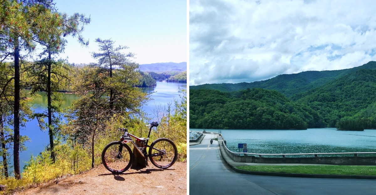
Some roads simply get you from point A to point B, but NC Highway 28 turns the drive itself into the destination.
Locals call it Moonshiner 28, and it winds through the mountains of western North Carolina past sparkling lakes, a massive dam, deep forest, and roadside waterfalls that appear almost out of nowhere.
It’s quieter than its famous neighbor, the Tail of the Dragon, which means fewer cars rushing past and more room to actually take in the views.
Fall adds another layer entirely, as the surrounding ridgelines light up in color and reflect straight off the water below. Grab a full tank of gas and a good playlist, because these tips will help you enjoy every curve along the way.
1. Why Moonshiner 28 Is The Lake Drive To Take
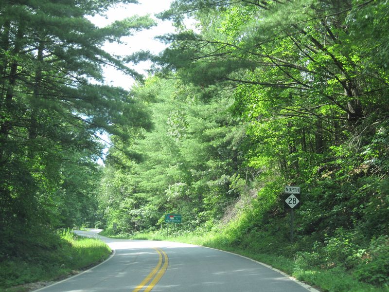
Long before tourists showed up with cameras, bootleggers raced along these hollows hauling homemade liquor during Prohibition.
That wild history gave North Carolina Highway 28 its famous nickname, Moonshiner 28. Today the same curvy route rewards drivers with some of the prettiest scenery in the western mountains.
The road begins at Deals Gap, right where the Tail of the Dragon on US 129 ends. From there it runs about 103 miles southeast through Franklin and Highlands before crossing into Georgia and South Carolina.
Along the way you pass mountain lakes, one of the tallest dams in the country, national forest land, and splashing waterfalls, all in a single trip.
Crowds are a big reason people fall in love with it. The Tail of the Dragon draws huge numbers of riders, yet Moonshiner 28 usually feels calm and relaxed. You can take your time and actually enjoy what you see.
Planning makes a big difference here. Give yourself a full day, or split the drive in two with an overnight stay in Franklin or Bryson City. A slower pace leaves room for hikes, snacks, and plenty of photo stops.
Gas stations get scarce on some remote stretches, so fill up whenever you have the chance. Cell service can also fade in the hills, which makes a paper map or downloaded directions a smart backup.
Most important of all, keep your speed low. The road has tight curves and sharp drop-offs with little room for mistakes. Driving carefully keeps everyone safe and lets you notice the small wonders, like mist rising off the water or a hawk circling overhead.
2. Cheoah Lake Sets The Scene In The Opening Miles
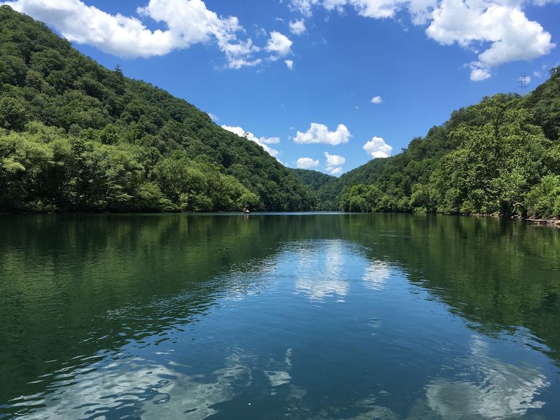
Barely a few minutes after leaving Deals Gap, the trees open up and a ribbon of blue water appears beside the road.
That first glimpse is Cheoah Lake, and it is a wonderful welcome to the trip. Steep, forested ridges climb straight out of the water, making the lake look tucked into a secret valley.
Cheoah Lake is long and narrow, stretching along NC-28 between Deals Gap and Fontana Dam. Because it sits right next to the pavement, you get lake views almost immediately. You do not have to wait hours for the good part to start.
Your North Carolina Garden Changes Every Week. Your Plan Should Too.
Gardening in North Carolina changes quickly throughout the season. Every Friday you’ll receive a simple weekly plan showing exactly what to plant, prune, fertilize, harvest, and protect so you never miss the right timing.
Early mornings are especially magical here. The water is often calm and glassy, and the soft light makes the green hills glow. Wisps of fog sometimes float over the surface, giving photos a dreamy feel.
Stopping for pictures is tempting, but be choosy about where you pull over. Use only real pull-offs where your car fits completely off the road. Stopping on a curve or a narrow shoulder can put you and others in danger.
Motorcycles and cyclists love this area too, since many riders come straight from the Tail of the Dragon. Watch carefully on every bend and give them plenty of space. A little patience goes a long way on these twisty roads.
Part of the charm is the quick change in mood. One moment you are near one of the busiest thrill roads in the country, and the next you are gliding past peaceful water. For many travelers, Cheoah Lake is where the real vacation feeling begins.
3. Fontana Dam Is The Tallest Dam East Of The Rockies
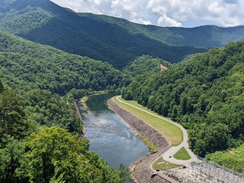
Standing 480 feet tall, Fontana Dam is the tallest dam east of the Rocky Mountains. That is taller than many city skyscrapers! Seeing it in person makes you feel tiny in the best possible way.
The Tennessee Valley Authority built the dam between 1942 and 1944, right in the middle of World War II.
Workers moved fast because the country needed electricity for factories making wartime supplies, including aluminum for airplanes. Thousands of people lived nearby in a camp that later became Fontana Village.
Getting there is simple. Watch for the short turnoff from NC-28 and follow the signs to the dam. Parking is easy, and the views start the moment you step out of the car.
Visitors can walk or drive across the top of the dam. On one side, Fontana Lake spreads out toward the Great Smoky Mountains. On the other side, the huge concrete wall drops away toward the river far below.
Hikers might wander past you, too. The Appalachian Trail crosses right over the dam, so you may meet backpackers on their long journey between Georgia and Maine. Many are happy to share a friendly hello or a story from the trail.
Stop by the visitor center to learn how the dam came together so quickly. The exhibits and photos help the whole place make sense. Bring a jacket as well, because the top of the dam can get breezy even on warm days.
For North Carolina, Fontana Dam remains one of the most impressive engineering landmarks in the entire state.
4. Fontana Lake Is The Largest Lake In Western North Carolina
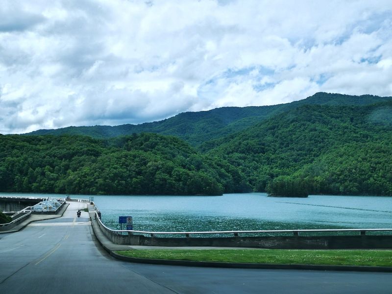
Imagine a lake so wild that most of its shoreline has no houses, no shops, and no busy docks.
Fontana Lake is exactly that kind of place. Forests of the Great Smoky Mountains National Park and Nantahala National Forest wrap around the water, keeping it beautifully untouched.
Fontana Dam created the lake by holding back the Little Tennessee River. The water now stretches for about 29 miles along the southwestern edge of the national park. That size makes it the largest lake in the western part of North Carolina.
Clear water is one of its best features. On sunny days you can often see down into the shallows, where the water shifts from green to deep blue. Remote coves hide around almost every bend.
The road only shows you part of the story. To really enjoy Fontana, rent a boat, kayak, or pontoon from a local marina. Out on the water you can reach quiet spots that no car could ever get to.
Keep binoculars handy while you explore. Eagles, herons, and deer are sometimes spotted along the shore, and a patient eye can catch plenty of surprises. Morning and evening are usually the best times for wildlife.
Plan ahead for weak or missing cell service in some areas. Tell someone your plans, carry a charged phone, and pack water and sunscreen. Those small steps help a big day on the lake stay stress free.
Once you float in one of its hidden coves, you will understand why so many people call Fontana their favorite lake.
5. The Indian Lakes Scenic Byway Follows The South Shore
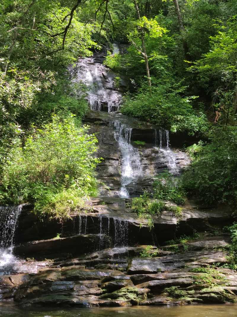
Ask road trip fans about the best part of Moonshiner 28, and many will point to this stretch.
East of Fontana Dam, NC-28 hugs the south shore of Fontana Lake for about 25 miles toward Almond. This section is known as the Indian Lakes Scenic Byway, and it truly earns that name.
Around each curve, the lake peeks through the trees. Across the water, the high peaks of the Great Smoky Mountains rise in layer after layer of blue ridges. Mixing lake and mountain views like this is something few North Carolina drives can match.
Several marked overlooks give you safe places to pull over. They are the best spots for photos, and each one shows the lake from a slightly different angle. Take a few minutes at each stop rather than snapping pictures from a moving car.
Timing can make your trip even better. October usually brings peak fall color, when the hills turn bright orange, red, and gold. The colors reflect off the lake and make the whole scene sparkle.
Summer offers its own rewards, with deep green forests and warm breezes. Spring brings blooming wildflowers along the roadside. Honestly, there is no bad season here, only different kinds of pretty.
Build extra time into your schedule for this part of the drive. Twenty-five miles sounds short, but you will want to stop again and again. Pack snacks, relax, and let the byway set the pace for your afternoon.
6. Tsali Recreation Area Offers Trails On The Water
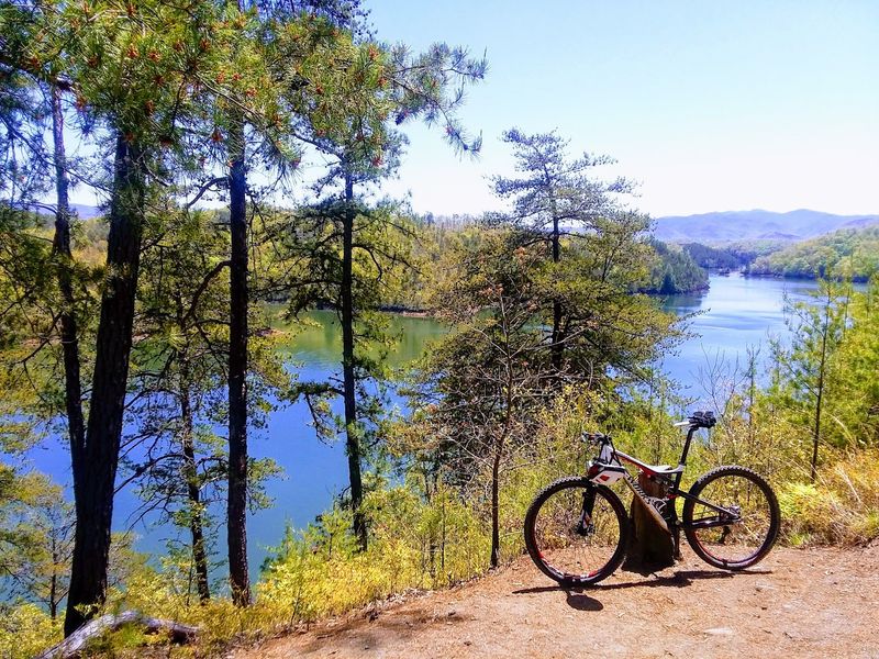
After hours behind the wheel, your legs will be begging for a break. Tsali Recreation Area is the perfect answer. Tucked along the shores of Fontana Lake, it gives you a chance to leave the car behind and feel the lake up close.
Mountain bikers know Tsali well. It is one of the best-known trail areas in the western mountains, and riders travel from far away to enjoy it. Horseback riders love it too, and the trails loop right along the edge of the water.
Views pop up often as you move. One minute you are rolling under tall trees, and the next you see sparkling water with mountains behind it. Few trail systems blend forest and lake quite so smoothly.
Before you go, check the current trail schedule. Tsali has rotated certain trails between bikes and horses on different days, so what is open can change. Hikers should also check which paths work best for walking that day.
Pack plenty of water and a few snacks, even for a short outing. Mountain air can fool you into thinking you are not thirsty. A granola bar at a quiet lakeside spot can feel like a fancy meal.
Keep your plans realistic if you still have miles to drive. A shorter ride or easy walk will refresh you without wearing you out. Save the long loops for a day when Tsali is your main stop.
Either way, the fresh air and sounds of the lake make it a highlight worth slowing down for.
7. Take A Side Trip To Lake Santeetlah
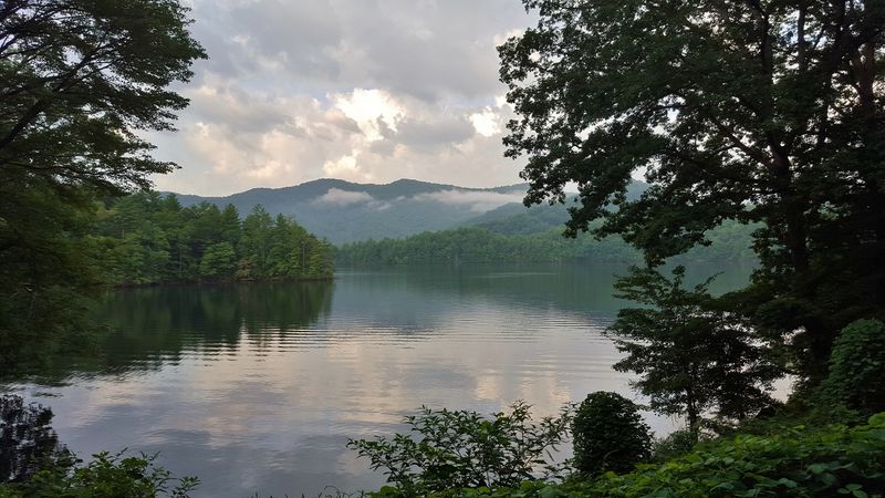
Sometimes the best surprises come from taking a little detour. Lake Santeetlah sits just north of Robbinsville, wrapped in the thick green woods of the Nantahala National Forest. Peaceful and quiet, it feels like a well-kept secret.
Reaching it from Fontana Dam is easy. Continue past the dam on NC-28 and connect with US 129 heading toward Robbinsville. The drive itself is lovely, with forest views that keep you smiling the whole way.
Once you arrive, you will find calm coves, campgrounds, boat launches, and hiking trails. Crowds are usually lighter than at bigger lakes, so you can often find a spot all to yourself. Many visitors say it pairs nicely with a Fontana visit on the same trip.
A picnic is one of the simplest ways to enjoy it. Pack sandwiches, fruit, and a cold drink, then find a shady place near the water. Listening to birds while you eat beats any restaurant in town.
Got extra time? The Cherohala Skyway starts nearby and climbs high into the mountains toward Tennessee. Its overlooks show off rolling ridges for miles, especially at sunset.
Graham County, home to Lake Santeetlah, remains one of the most remote and least developed parts of North Carolina.
That means fewer stores and services, so stock up on supplies beforehand. It also means dark night skies, fresh air, and a slower pace of life.
For travelers craving calm, this small detour might become the part of the trip they remember most.
8. Waterfalls Along The Mountain Waters Scenic Byway
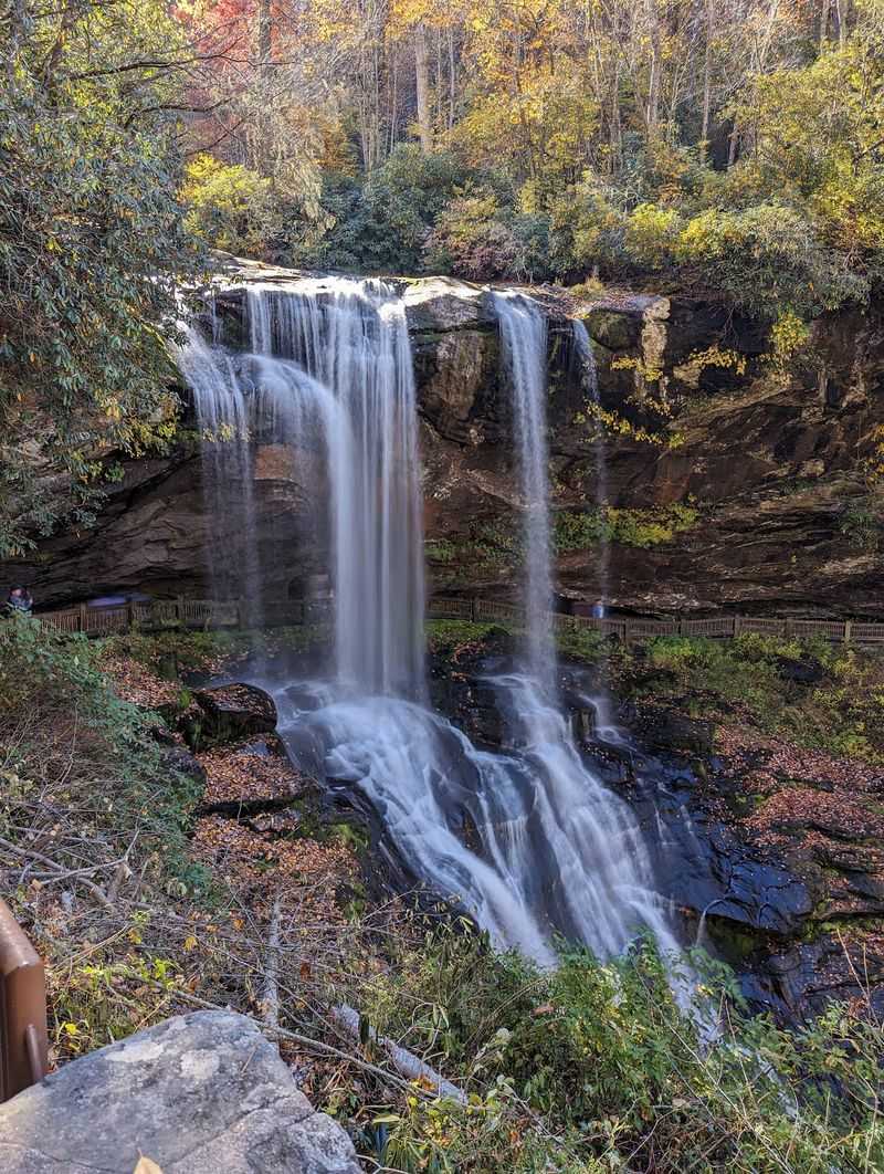
Every great road trip deserves a big finish, and this one saves the drama for last. Near Highlands, the route connects with US 64, known as the Mountain Waters Scenic Byway. The name fits, because waterfalls tumble right beside the highway.
Bridal Veil Falls is one of the most famous stops. Water spills over a rocky ledge next to the road, and an old section of pavement once let cars drive right behind it. Today you can park nearby and admire it up close.
Further along, the road threads through the steep Cullasaja River Gorge. Cliffs rise on one side, while the river rushes far below on the other. Several more falls appear along the way, adding a splash of excitement to every mile.
Safety matters a lot on this stretch. The road is narrow and curvy, so stop only at designated pull-offs. Pulling over anywhere else can surprise other drivers in a hurry.
Near the waterfalls, stay behind the barriers and on marked paths. Wet rocks are extremely slippery, even when they look dry. A great photo is never worth a bad fall.
Plan to drive the gorge during daylight hours. Darkness makes the sharp curves harder to see, and you would miss the best views anyway. Morning or early afternoon usually works beautifully.
Highlands and its surrounding gorge rank among the most scenic waterfall areas in North Carolina. Ending your Moonshiner 28 adventure here leaves you with memories that sound like rushing water.